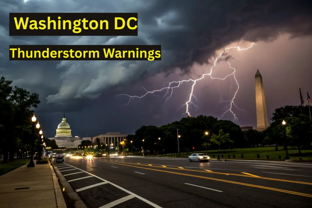
DC Braces for Double Whammy of Floods and Severe Storms
WASHINGTON, D.C. — The muggy air hangs thick enough to slice as National Weather Service radar screens flash crimson over the District. With floodwaters still receding from last week’s downpours, the nation’s capital faces a dangerous one-two punch: a Flood Watch and Severe Thunderstorm Watch in effect through Wednesday evening, followed by an even fiercer threat Thursday.
The Immediate Danger: Right Now Through Dusk
Sweaty shirtsleeves cling to commuters as the first rumble echoes across the Potomac shortly after noon—earlier than typical D.C. storms. Meteorologists warn these initial cells could unleash:
60+ mph winds capable of snapping tree limbs and downing power lines across saturated neighborhoods like Georgetown and Capitol Hill
Flash flooding from torrential rains (1-3 inches per hour), turning streets like K Street NW into rivers within minutes
Baseball-sized hail in isolated supercells, particularly west of I-95
“The ground is already screaming ‘uncle’,” explains one NWS forecaster. “Two inches of rain fell near Rockville yesterday. Add today’s downpours, and we’re looking at urban flooding that could trap cars, swamp basements.” Reagan National Airport reports scattered delays as lightning creeps closer.
Thursday’s Escalated Threat: “A Different Beast”
While Wednesday’s storms scatter like firecrackers, Thursday’s system promises organized fury. By afternoon, a Level 2/5 severe risk blankets the Beltway with:
Damaging straight-line winds (58+ mph) sweeping from northern Virginia through Baltimore
Isolated tornadoes possible along I-95 corridors as wind shear intensifies
Continuous lightning and hail threatening evening commutes
“This isn’t your typical D.C. pop-up storm,” a forecaster stresses. “We’re tracking a mature system that tore through the Midwest with 101-mph winds in Kansas yesterday. It’s packing serious momentum.”
Why This Feels Different
Three factors amplify the danger:
Soggy Setup: Weeks of above-average rainfall have turned soil into sponges. “When the next inch falls, it has nowhere to go but into streets and sewers,” says DC Water’s emergency manager.
Heat Engine: Near-90°F temps combined with tropical humidity create explosive atmospheric fuel.
Back-to-Back Hits: With minimal recovery time between systems, infrastructure fatigue sets in. “Crews are still clearing debris from Monday,” notes a PEPCO outage coordinator.
Protection Over Panic: What You Should Do
Until 7 PM Wednesday: Avoid unnecessary travel. If caught driving and water covers the road, turn around. Six inches of moving water can sweep away vehicles.
Thursday 2-11 PM: Secure patio furniture, charge devices, and identify your safest interior room (no windows). Tornadoes may spin up with little warning.
All Week: Monitor weather radios and local alerts—not just apps. Cell networks often fail during severe outbreaks.
The Silver Lining
By Friday, high pressure shoves the storms offshore, bringing sunshine and drier heat. But for now, as weather radios chirp with warnings across federal offices and row houses alike, the message is clear: Don’t underestimate these storms. When the sky turns highway-sign green—that’s your cue to take cover, not snap photos.
Pro tip: Bookmark the National Weather Service’s real-time flood map for street-level alerts. And maybe pour a stiff drink—you’ve earned it after surviving D.C.’s atmospheric gauntlet.